
FINALLY!
After spending MANY hours searching forums, web sites, picture galleries, etc., I have found something of what I was looking for.
This website: http://alt.ngs.noaa.gov/katrina/KATRINA0000.HTM allows you to click on an area & find a current satellite picture of Biloxi.
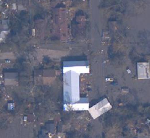
I've also enlcosed a pic on this blog - I was actually able to zoom in & crop so you can just see Moore Community House.
The large U-shaped building towards the middle/bottom with the shiny roof is Epworth Church. The house sitting awkwardly next to it is awkward for a reason - it used to be across the street.
If you look towards the top of the picture, you'll see a clump of brown-topped buildings. The one in the middle (if there is a middle) that stretches back farther than the others is my house. My apt. would be the space farthest to the top of the picture. It is hard to tell whether the dark spots on the roof are age-worn or damage. I can tell that on the left side of picture - there is a shadowy portion. That is where the peak of my windows are - that is not damage. I cannot say the same for the large shadow on the very top of the picture - towards the "back" of my apartment.
The building to the left of my building is my office building - you can even see where our head start bus is parked next to the building. It appears that many of our trees are down, and that our playground equipment is scattered.
Will keep updating as I get word.
posted by Becky @ 2:37 AM
![]()
0 Comments:
Post a Comment
<< Home